
Soaring Academy’s Favorite Lift Sources
SUMMER (April through October)
THE SAN GABRIEL MOUNTAINS
When flying mornings in the April-October season, you can expect terrific thermal lift over the higher ridges of the San Gabriel Mountains. Because they are mostly very steep and narrow at the top, in light winds it is possible to fly along directly above the crests, climbing steadily in thermal lift from both sides at once. Then, wherever multiple faces meet at prominent peaks, tremendous thermals flow together and offer climbs that are sometimes unbelievable. I have been at 13,000 MSL before 11:00 AM. If you're going cross-country and cumulus clouds are not already forming over the desert, don't leave the mountains before about noon. Then, by the time you have glided 30 miles, thermals should have triggered over the flat desert.
1. MORNING MOUNTAIN
Very often, the first thermal of the day rises from this smallest of the bigger mountains. It's southeast face is bare rock, facing the morning sun and also facing into a huge canyon that protects it from almost any wind direction. We have found 6 knot thermals there as early as 9:30 AM, when nothing else was working yet. Within an hour of the first lift there, that small hill is dwarfed by even better lift from bigger terrain all around it.
2. MINGHELLI'S CHIMNEY
Located on the south side of the `second', or `middle' ridge (officially named Pinyon Ridge), crest elevation: 6500 feet MSL. This ridge produces very strong thermals, April through October, starting about an hour before thermals trigger on lower ground. There is seldom any need to tow higher or farther for a good start to a great flight.
3. THE LABOR CAMP
At the east end of Fenner Canyon, between the second ridge and the big mountains, Baden-Powell and Lewis. Air flowing in from the west is forced up at head of the canyon. From these lower thermal sources you can get high enough to attack the bigger terrain and search for even better lift.
4. MOUNT LEWIS
At 8300 feet, this mountain is far from the largest in our area, but is usually the best. It is an isolated cone with about five different faces that meet at a sharp peak (the side that faces the afternoon sun is dark brown rock…). On any given summer afternoon, Mt. Lewis is where you'll probably find the best thermal for a hundred miles or more!
THE DESERT
1. HOUSE THERMALS GALORE
The runway and areas all around produce thermals that last about ten minutes each. When the one you are using is gone, look at the orange tetrahedron. Since it points into the surface wind, the next new thermal from the open ground of the airport will probably be straight downwind of it. "What goes up must come from somewhere."
2. THE DRY WASH
Big Rock Wash runs south to north, west of the airport. The stones are light gray, so I doubt that they heat very much, but the dry, sandy and darker areas on either side are the likely heat sources. The lift will be found over the wash.
3. BOB'S GAP
A mile and a half south of the airport a ridge runs east to west, which we call the `first ridge'. It is very small, and usually insignificant, but if you're low you can often make a save over a gap in the hill where air flowing either direction is broken loose from the surface.
4. SHEAR LINE LIFT
Upwind of the airport in the afternoon, look for hazy air pushing into the desert from the Highway 14 pass (Palmdale). Strong lift is to be found on the margin between the visible marine air and the clear desert air. Stay on the clear side.
5. PINYON HILLS - PHELAN
The west edge of the Cajon Pass shear line produces dust devils and very strong lift running from the mountains north to El Mirage Dry Lake and beyond. (Basically the same phenomenon as the shear line west of Crystalaire.)
6. NORTH OF WRIGHTWOOD
There is a tan colored alluvial fan large enough to be seen in satellite photographs. Devoid of vegetation, it gets hotter than the surface surrounding it, and therefore produces stronger thermals.
7. EL MIRAGE DRY LAKE
During the afternoon, large, very strong thermals last a long time there. This is due to the huge reservoir of super-heated air than collects on the lake bed throughout the first half of the day.
8. GRAY BUTTE
An old military airport lies just east of a dark cone of rock standing alone in the flat desert. Both features heat up more than the vegetation surrounding them, and provide dependable lift all afternoon.
WINTER (November through March)
WINTER LIFT SOURCES THAT REACH HIGH ALTITUDES CONSIST OF WIND-DRIVEN FORCES: SLOPE LIFT AND WAVES.
When public weather stations forecast strong winds below canyons in the Los Angeles basin (the "Santa Anna winds"), you can be fairly certain that we have good ridge soaring - and possible waves standing well upwind of the Mountains. I call them `bow' waves (rhymes with WOW!)
When rain is forecast in LA, with chances of rain in the desert, we expect conventional wave activity on both the day before and the day of the forecast rain. Then, when the front actually arrives, we often have cumulus clouds to mark the lift. The shear lines, although usually weaker in winter, can sometimes work well, too.
On a flight one December , we were running near cloud base at about 100 knots for as far as time allowed before turning back. The cloud base was low for this area (only a mile above the surface), but the lift that day was as strong and consistent as a typical day in summer.
THINK OF IT: CROSS-COUNTRY SOARING AT RESPECTABLE GROUND SPEEDS IN DECEMBER!
FOR SLOPE LIFT, the `second' ridge or the base of the big mountains south of the Devil's Punchbowl are good places to start. I like to soar to the west along Pleasant View Ridge. It's gentler terrain than many mountains in this area, and is easy to work. From the west end, turn back and make another pass. After reaching 9000 feet, you can go for the bigger terrain to get even higher - and look for wave.
FOR CLASSIC WAVE conditions in any wind from southeast to southwest, there could hardly be a more predictable spot than the Devil's Punchbowl. It is sometimes easy to thermal into wave there, or release after a three or four thousand foot tow, and climb away. We have even had fast climbs to 17,900 when the wind is from the west, parallel to the mountain chain!
When the wave is working at the Punchbowl, we usually have a secondary just about directly over the airport - and who knows how many harmonics downwind into the desert. We have plenty of opportunities to practice our thermaling skills in the winter, too. Sun-facing mountain sides often work consistently, and with post-frontal instability, we sometimes find usable thermals over the open desert as well. Also, in light northeast winds (common in winter), we have an amazingly predictable lift source: a wide pattern of dune-like ripples that act as a thermal trigger. The ripples lie less than two miles directly upwind from the airport, so that drift brings you toward the field - a pleasant convenience when scratching in weak winter thermals.
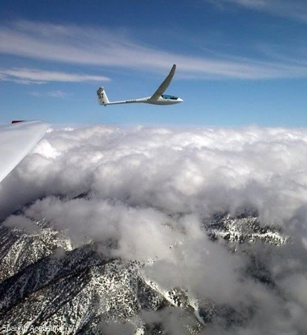
Winter wave here over the mountains. Picture by Dale Masters and Juliet Lima. (DG-500).